How to become an Open Street Map Contributor
 Leggi in Italiano
What is Open Street Map?
The Peaks dataset used in PeakLens is extracted from Open Street Map . OSM is a collaborative project to create a free editable map of the world (from WikiMedia).Currently OSM includes more than 200.000 peaks from all over the world, and the data set keeps growing.
If you notice a missing or incorrect peak using PeakLens, you can fix it directly on OSM.
How to add a new Peak on OSM
1. Open the website https://www.openstreetmap.org.2. Click on the “Login” button at the top right corner. If you do not have an account you can create one by clicking on the “Sign up” button and following the instructions.
3. Insert email, password and click on the “Login” button. Your name should appear on the top right corner in place of “Login” and “Sign Up”.
4. Locate the area where you want to add a peak by using the search bar on the left of the page. You can search the name of a place nearby or the exact coordinates with the format “Latitude, Longitude”.
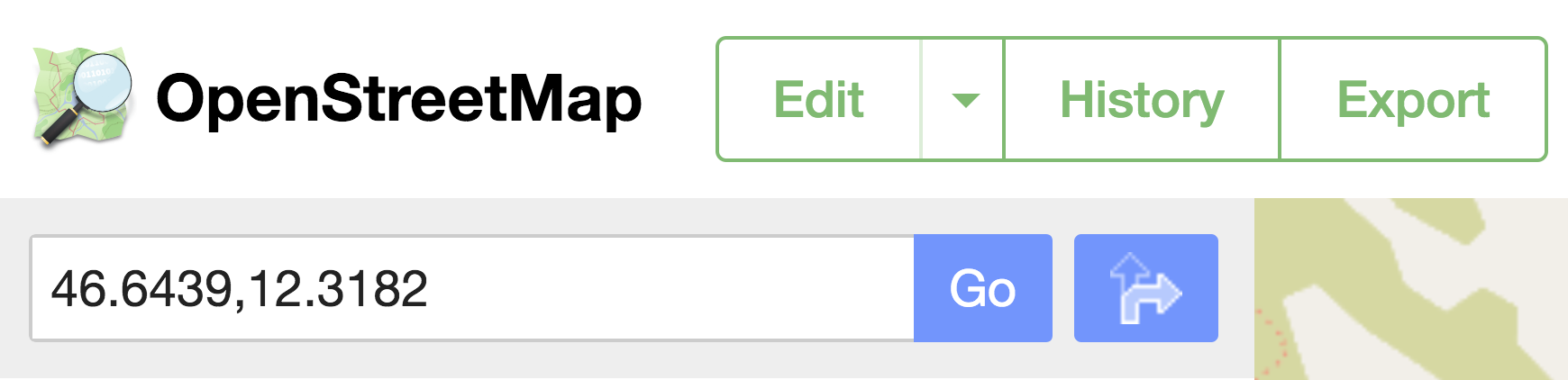
Clicking on the “Go” button a list of results will appear, choose one of them to center the map in that point.
5. Zoom in by using the mouse wheel or the “+” button on the right until the “Edit” button on the top left corner is enabled.


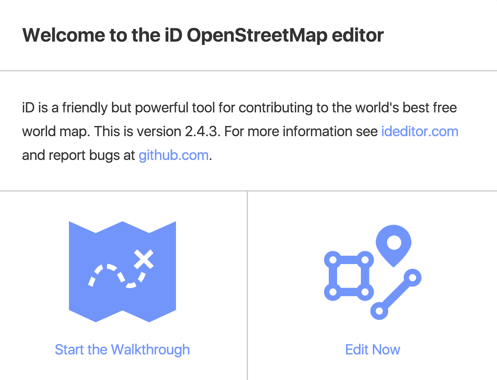
7. The window "Welcome to the iD OpenStreetMap editor" may appear.
If it does, click on the “Edit now” button.
If it does, click on the “Edit now” button.
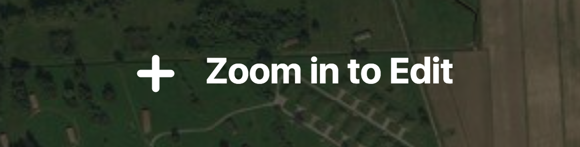
8. If the text "Zoom in to Edit" appears at the center of the map it is necessary to zoom in by using the mouse wheel or the “+” button on the right.
9. You can use this button on the right to change the background layer of the map.

10. Click on "Point" and the button changes state and the mouse pointer becomes a “+”.

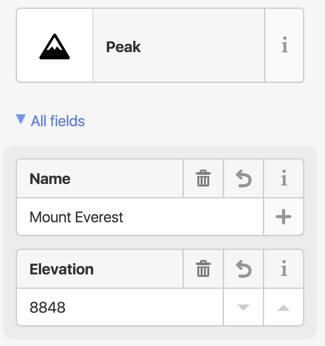
12. On the left a list of elements is shown: click on the “Natural Features” option and then on the “Peak” option.
13. On the left again, a window is shown asking for the name in the original language. Clicking on the “+” button next to the name it is possible to add the name in different languages. Below the name field it is possible to add the elevation of the peak in meters as an integer.
15. Once a peak is added, it is possible to add other peaks by following the same procedure from [10].
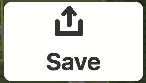
16. When the editing is completed click on "Save" to apply your changes.
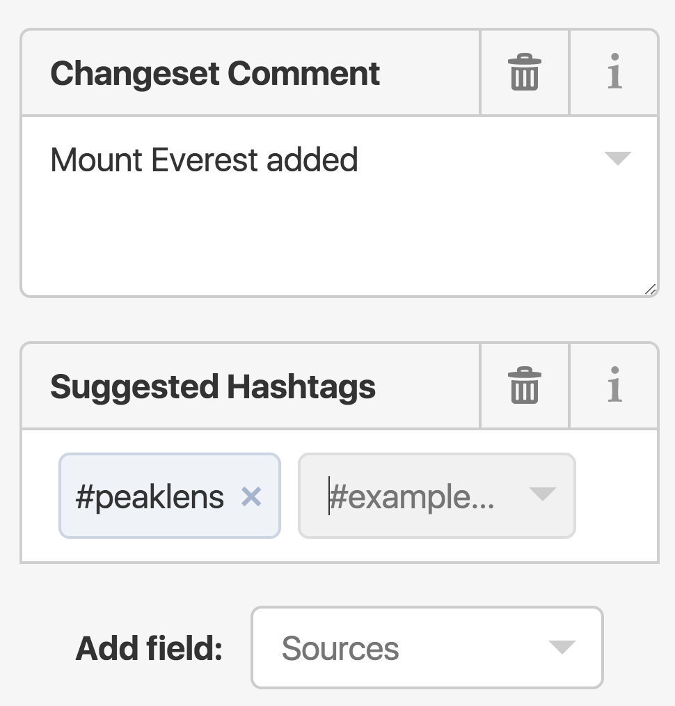
18. Using the “Add field” menu select the “Suggested Hashtags” button and then add “#peaklens” in the input box.
20. When the operation is completed, a success message will appear on the left.
For more information: info@peaklens.com.